Short Itinerary
Day 1: Cusco | KM 82 – Wayllabamba
Departure from Cusco to Kilometer 82. Begin the trek along the Urubamba River, passing the Llactapata ruins, and hike through the valley to the first campsite at Wayllabamba.
- Distance: 12 km / 7.47 miles
Day 2: Wayllabamba | Dead Woman’s Pass – Pacaymayo
A challenging ascent to the highest point of the trail, Warmiwañusca (Dead Woman’s Pass) at 4,200m. After enjoying the views and high-altitude scenery, descend to the Pacaymayo valley.
- Distance: 11 km / 6.84 miles
Day 3: Pacaymayo | Phuyupatamarca – Wiñaywayna
The longest day features visits to several archaeological sites including Runkurakay, Sayacmarca, and Phuyupatamarca. Descend through the cloud forest to the final campsite at Wiñaywayna.
- Distance: 16 km / 9.94 miles
Day 4: Wiñaywayna | Sun Gate – Machu Picchu – Cusco
Early morning hike to Intipunku (Sun Gate) for a first view of Machu Picchu at sunrise. Enjoy a guided tour of the citadel, explore on your own, and return to Cusco by train in the evening.
- Distance: 4 km / 2.49 miles
Itinerary
Day 1: Cusco – Start of Inca Trail, Kilometer 82
We will pick you up from your hotel in Cusco. We drive for 2 hours to Piskacuchu (2,700 m / 8,856 ft), a community located at ‘Kilometer 82’ which is the starting point of the Classic Inca trail to Machu Picchu. We begin our hike by crossing the bridge over the Urubamba River and walking along its left shore as to then ascend and finally see, from the tallest part of an overlook, the impressive Inca city of Llactapata (2,650 m / 8,692 ft). We continue trekking along the valley created by the Kusichaca River, gradually climbing for about five hours until we reach the community of Wayllabamba (3,000 m / 9,840 ft), where we set our first camp.
All along the way we enjoy spectacular views of the Vilcanota Ridge on the opposite side of the Urubamba river, where the impressive Veronica peak reigns at 5,832 meters above sea level. A wide variety of wild flora and fauna will be found all along the valley.
- Total distance: 12 km (7.47 miles)
- Estimated walking time: 5-6 hours
- Maximum altitude point: 3,000 m (9,840 ft)
- Campsite altitude: 3,000 m (9,840 ft)
- Meals Provided: L/D
Day 2: Wayllabamba to Pacaymayo
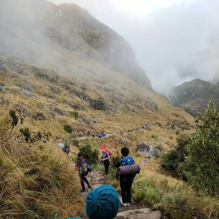
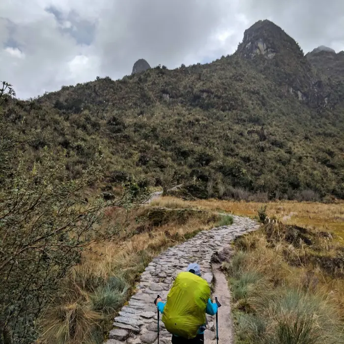
We wake up at around 6:00 am and after breakfast we begin the most difficult part of the trek, which consists of an abrupt and steep ascent that stretches for 9 km. along this climb, the landscape changes from sierra to puna (a dry and high area with little vegetation).
On the way to the first mountain pass, the Abra Warmiwañusca (Dead Woman´s Pass – 4,200 m / 13,776 ft), we may see domesticated llamas and alpacas grazing on ichu, one of the few plants that grow at high altitude. We also cross an area of the so called cloud forest, which is the habitat for many different kinds of birds like hummingbirds and sparrows, and the andean bear, which is also called the Spectacled Bear (Tremarctus Ornatus). We advise that on this day specially, your daypack is well stocked with candies, chocolates and coca leaves that will keep your sugar level high, and help with altitude.
Immediately after the pass, we descend into the Pacaymayo valley (3,600 m / 11,808 ft), where we camp after approximately 7h of hiking.
- Total distance: 11 km (6, 84 miles)
- Estimated walking time: 6-7 hours
- Maximum altitude point: 4,200 m (13,776 ft)
- Campsite altitude: 3,500 m (11,480 ft)
- Meals Provided: B/L/D
Day 3: Pacaymayo to Wiñaywayna
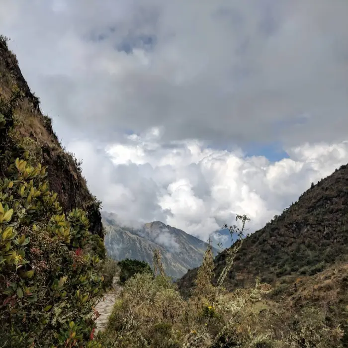
This day is the longest but also the most impressive and the most interesting, due the number of archaeological sites and the lush cloud forest area that we cross, rich in Andean flora and fauna.
From Pacaymayo we climb to the second pass, the Abra Runkurakay (3,970 m / 13,022 ft). Halfway up, we stop to visit the archaeological complex with the same name. This site, located at 3,800 m / 12,464 ft, consists of a small oval structure that is believed to have served the purpose of a watchtower.
After going over the pass, we descend towards Yanacocha (Black Lagoon) and enter the cloud forest to finally arrive at Sayacmarca (3,624 m / 11,887 ft). This is a beautiful complex made up of a semicircular construction, enclosures at different levels, narrow streets, liturgical fountains, patios and irrigation canals. Continuing up an easy climb, we arrive at the third pass, the Abra Phuyupatamarca (3,700 m / 12,136 ft). Along this climb we can appreciate the magnitude of the Incas´ ancient craft, by walking along paths semi-detached from the mountain, and seeing rocks that fill up ravines in perfect order, saving the trail from the multileveled Andean geography.
We go through an Inca tunnel to later arrive at the aforementioned pass and down to the complex of the same name. This is one of the most complete and best-preserved archaeological complexes along the Classic Inca Trail to Machu Picchu, and is located on the highest point of a mountain. Curiously, Phuyupatamarca means ¨town over the clouds¨. From above, one can observe a sophisticated sacred complex made up of water fountains with solid foundations, and also impressive views of the Urubamba River valley.
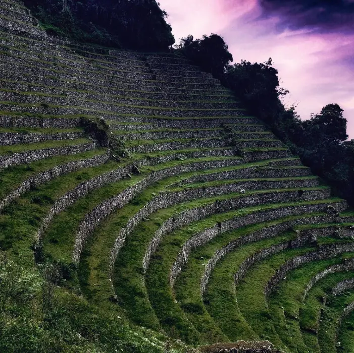
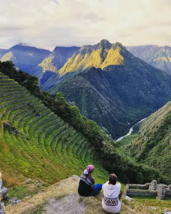
We continue our Inca Trail Trek down the long descending stone steps that lead us to Wiñaywayna (2,650 m / 8,692 ft), an impressive Inca complex made up of an agricultural center with numerous terraces, a religious sector and an urban sector, close to which our camp is located.
After visiting the impressive archaeological site, we enjoy our farewell dinner at our camp.
- Campsite altitude: 2,650 m (8,692 ft)
- Total distance: 16 km (9, 94 miles)
- Estimated walking time: 8 hours
- Maximum altitude point: 3,900 m (12,792 ft)
- Meals Provided: B/L/D
Day 4: Wiñaywayna to Machupicchu
On this fourth and final day we get up at 3:30 am to leave Wiñaywayna an hour later and climb to the Intipunku, or The Sun Gate. This will take an hour of hiking along a trail of flat stones on the edges of cliffs in highland jungle. From this fabulous spot, we may see the sunrise over the sacred citadel of Machu Picchu. From Intipunku we descend into Machu Picchu, and 40 minutes later we enter the citadel from the highest point through the ¨House of the Guardians¨. We then descend to the control point where we register ourselves and leave our backpacks. We immediately begin a complete guided tour of the Inca citadel that will take approximately two hours. You will then have free time to walk around the city and visit the impressive Inca Bridge on your own.
In the afternoon, we meet in the town of Aguas Calientes where, if you like, you can visit and relax in its hot springs. From here we take the train back to the city of Cusco, where we arrive after nightfall.
- Total distance: 4 km (2, 49 miles)
- Estimated walking time: 2 hours
- Maximum altitude point: 2,700 m (8,829 ft)
- Machupicchu altitude: 2,400 m (7,872 ft)
- Meals Provided: B
Important:
** Campsites are subject to change according to the designation of the governmental institution regulating.
Degree of Difficulty:
The entire 4 day trail Trek to Machu Picchu is 28 miles (45 km) so the distances travelled each day are not terribly long. It is generally accepted that anyone who is accustomed to hiking and camping (i.e. walking for several hours and sleeping in tents) can hike the Inca Trail, however, the altitude can make hiking these distances feel about twice as difficult as hiking the same distance at sea level.
Inclusions & Exclusions
What is Included:
- Professional Staff: Expert local guide, professional cook, and a team of porters to carry equipment.
- Camping Equipment: High-quality tents and foam mattresses for 3 nights of camping.
- Machu Picchu Entry: A comprehensive guided tour of the Machu Picchu citadel.
- Transportation: Return train ticket and a one-way bus ticket.
- Meals: All meals during the trek (from Day 1 lunch to Day 4 breakfast).
What is Not Included:
- Personal Gear: Sleeping bags and blow-up mattresses (available for rent in Cusco).
- Specific Meals: Breakfast on the first day and lunch on the last day in Aguas Calientes.
- Gratuities: Tips for the guide, porters, and other staff members.
- Additional Equipment: Walking sticks/trekking poles (available for rent).
FAQs: Classic Inca Trail to Machu Picchu
How difficult is the Inca Trail trek?
The trek covers approximately 45 km (28 miles) over four days. While the distances aren’t extremely long, the altitude can make the hike feel twice as difficult as walking at sea level. It is recommended for travelers who are accustomed to hiking and camping.
What is the highest point of the trek?
The highest point is reached on Day 2 at Abra Warmiwañusca (Dead Woman’s Pass), which sits at 4,200 meters (13,776 feet) above sea level.
Do I need to bring my own camping gear?
The tour includes tents and foam mattresses. however, sleeping bags and blow-up mattresses are not included. You can bring your own or rent them in Cusco (Sleeping bag: $20 / Blow-up mattress: $15).
What should I carry in my daypack to help with the hike?
It is highly recommended to keep your daypack stocked with candies, chocolates, and coca leaves. these help maintain your sugar levels and assist with altitude adjustment, especially during the steep climb on Day 2.
Are all meals included in the tour?
Most meals are included from lunch on Day 1 to breakfast on Day 4. However, you will need to cover your own breakfast on the first day and lunch on the final day in Aguas Calientes after visiting Machu Picchu.